![]()
The Seljuk Han of Anatolia
HEINRICH AND RICHARD KIEPERT
 |
|
|
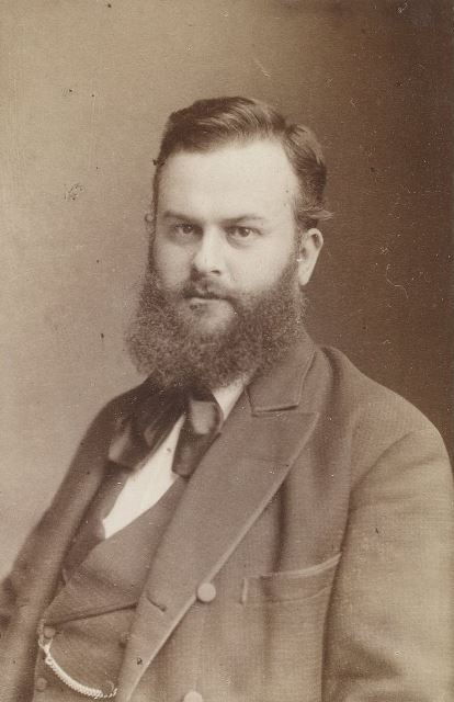
Heinrich Kiepert (1818-1899)
|
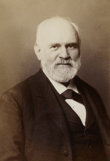
Richard Kiepert (1846-1915) (photograph by Adolf Halwas) |
|
|
|
Treasure maps of the Great Game in service to the Seljuks…
It is estimated that the Seljuks built some 400 Seljuk hans, yet only some 100 remain today. Where are the others? Research on Seljuk architecture often proves to be a treasure hunt, for the traces of many of the buildings described in historical texts have disappeared. They certainly existed, but have been lost over the years due to the Mongol invasions, wars, earthquakes, neglect and modern property developers. Others are still there, however, waiting to be discovered and excavated by eager art historians and archeologists.
In addition to the notations left in historical texts – and Ibni Bibi left many precise descriptions, notably of the palaces of Kubadabad and Keykubadiyye – the writings of 19th century travelers to Anatolia, such as Ainsworth, Van Lennep and Pace have proved helpful in identifying hans. These travel journals often leave concrete evidence to the existence and location of a han at that time. Most of these travelers were not investigating hans – that would come later with Sarre, Herzfeld and Erdmann – but were antiquarians, archaeologists, and epigraphers interested in documenting ancient Greek and Byzantine remains or scouting information for commercial or military objectives. As such, their journals generally leave only cursory remarks concerning the hans they encountered on their way.
However, another pertinent source of historical documentation exists: maps. These include the maps of Ritter and de Jerphanion, but in this domain, no set of maps has spoken more about the location of hans than those made by Heinrich and Richard Kiepert, the famous father and son cartographers from Germany. The maps of the Kiepert père et fils are invaluable on many levels, not only as documentation for the state of Turkey at the time they were made, but as a backdrop to Germany’s involvement of the Great Game of political power preceding World War I as well.
Geographer Heinrich Kiepert (1818-1899) is generally reckoned as one of the more important scholarly cartographers of the second half of the 19th century. Kiepert acquired one of his interests—the historical geography of the classical world—in his student days at the University of Berlin, where he worked with Carl Ritter (1779-1859). Ritter and Kiepert produced what appears to have been one of the first modern atlases of the ancient Greek world, the Topographisch-historischer Atlas von Hellas und den hellenischen Colonien in 24 Blättern (1840-1846). Another major interest of his was the Ottoman Empire. Heinrich Kiepert traveled to Asia Minor four times between 1841 and 1848. He created two maps of the region, including the Karte des osmanischen Reiches in Asien in 1844, and the Specialkarte vom Westlichen Kleinasien which appeared in 1890-1891 (15 sheets at 1:250,000). Following the publication of these maps, Heinrich became known as the foremost authority on the geography of the Near East and an icon of German cartographic expertise. Such was his renown that he makes a cameo appearance in a scene in Pierre Benoit's 1918 novel Koenigsmark. He also made many maps for the Baedeker travel guides, which must have been a lucrative practice.
Like father like son:
The apple did not fall far from the tree: Heinrich’s son, Richard Kiepert (1846-1915), also became a famed cartographer. After his father's death in 1898 he completed or brought up to date many of his father's maps.
Richard pursued geographical and historical studies at Berlin and Heidelberg universities. In 1870 he traveled in Palestine and Asia Minor, returning to take part in the Franco-Prussian War. He worked on the compilation of Richthofen's atlas of China, and revised maps of the data collected by many well-known German travelers. He became a household (or rather a “school-hold” name) with the publication of a set of maps on Germany and the world regions which hung on the walls of every classroom in Germany. A whole generation of Germans learned of the world through the colorful maps of Richard Kiepert.
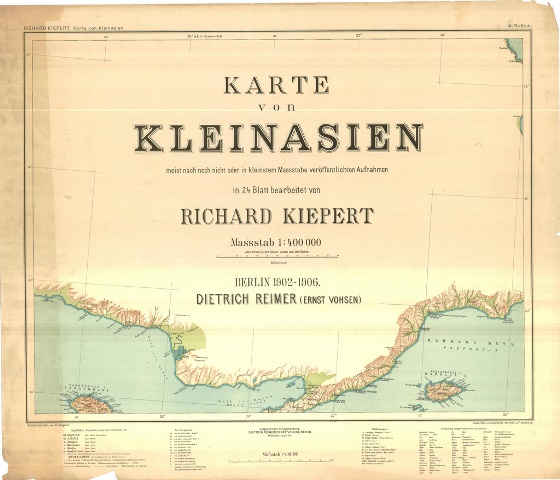
As concerns han-hunting, the most famous of the maps made by Richard Kiepert is the Karte von Kleinasien. This is a set of 24 sheets at 1:400,000, published by Reimer between 1901 and 1907, then repeatedly revised (1908-1916), and later reissued in 1929. Although Richard published the set of maps that are the most consulted for han archaeological work, his debt to his father cannot be underestimated. Who really did draw these maps in the end? The son completed the father’s work, and it must have been an emotional filial experience to so honor him. Richard Kiepert also participated on the archaeological expeditions of John Robert Sitlington Sterrett of Cornell University and Tschihatscheff.
Chasing hans or chasing power?
There is a much bigger story behind the maps of Kiepert than helping modern archeologists to pinpoint hans. These maps were not done to document hans and archeological points of interest – that was only a lagniappe to the endeavor. They were created to serve as a weapon in the complex power game in play at this time in the entire Middle East: the so-called “Great Game”, in which no one really won and whose consequences we are still debating today. The maps of the Kieperts reveal the optimism of the Germans to enter the Great Game played in the Near East by the English and the Russians right up to World War I.
Germany planned to enter the game with a grand German-Ottoman alliance. It was a win-win situation for both, it would seem. The crumbling Ottoman Empire was broke and had no money to invest in military campaigns; the ambitious and wealthy German Empire wanted a piece of the Great Game action at little cost, and, at the same time, a way to upset the British plans in the area. Germany could not aspire to colonies on a scale with Britain (who could?) or to the expansive territories of Russia, but it did have lots of capital, which guided its strategy. This strategy consisted of investing heavily in infrastructure and convincing the Turks that they only wanted a pure business partnership with shared profits and nothing more. The Turks, reassured that their territories would not be in jeopardy, jumped at the offer.
Those German business deals were centered on the construction of railways. Sultan Abdul Hamid II (r: 1876-1909) was an ardent fan of modernism, and what could herald the new age for his horse cart empire more than the swift wheels of a steaming locomotive? The first goal of the Germans was to create a link from Istanbul clear to the Persian Gulf. The prescient German geologists were convinced that the region possessed immense reserves of oil, an assumption proven true by 1908. The Germans undertook the construction of the Baghdad Railway, linking Berlin to the Persian Gulf and beyond. This railway would allow the possibility of moving large numbers of troops to the heart of the Middle East in only a few days – much faster than the British or the Russians. The Germans then put into operation their second strategic scheme: to build a railroad all the way to the Red Sea, which would threaten Britain’s naval dominance over the sea and its link to India and the East via the Suez Canal. The Ottomans, who for years dreamed of having a rail link from Istanbul to Medina and Mecca, eagerly accepted this plan. To unite the religious imperatives of fulfilling the Hajj with greater ease and the German ambitions for military and economic power was a surefire arrangement indeed.
Alas, many good plans go astray, and this railroad business of the German-Ottoman alliance was one such victim. Everything collapsed during World War I (1914-8), with the British seizing Iraq and T. E. Lawrence disabling the Hejaz Railway linking Damascus to Medina (who can forget that memorable scene in the film “Lawrence of Arabia”?). After the war, Germany was utterly vanquished and the Ottoman Empire collapsed, largely to Britain’s gain, making her the undisputed master of the Persian Gulf and appropriating its oil reserves. The rest is history, so they say.
Richard Kiepert’s maps lived on in other variants. Never to be left behind, the British during World War I undertook the creation of a series of maps of Eastern Turkey, largely based on Richard’s Karte von Kleinasien as well as from Turkish staff maps captured in 1915, that were little more than an enlargement of Karte von Kleinasien with Turkish names transliterated English-style. The Ottomans as well between 1908 and 1916 made a rapidly-revised version of the Karte von Kleinasien sheets covering central and eastern Asia Minor (maintaining Richard's 1:400,000 scale), as well as enlargements at 1:200,000 of all its sheets.
How accurate are the maps of Richard Kiepert?
Kiepert's maps are almost invariably clear and easy to read, and they are as accurate as the scholarship of the day permitted. It is difficult in our modern age, with satellites, GPS points, and advanced topographic measuring tools, to understand the complexity of map drawing from antiquity through the 20th century. Map making, then and now, is an arduous and complex business. The collection of data on the ground in Anatolia was challenging, with trials posed by rudimentary means of transport through punishing terrain, a brutally hot and cold climate, lack of fresh water, unpalatable diet, uncooperative local authorities and peasantry, multiple names used to designate one place, and linguistic challenges which necessitated a translator and a valet de place. The fundamental difficulties of acquiring physical, cultural and demographic data and assessing its accuracy constitute an endeavor that few who are not on the ground can understand. The French priest Guillaume de Jerphanion, resident since 1903 at Tokat in the Pontus region of northern Turkey, was himself a cartographer and produced an important map of the region (Carte du Bassin Moyen du Yéchil Irmaq, 1:200,000, 4 sheets, Paris, 1913). Father de Jerphanion reviewed the Kiepert maps first hand for a scholarly journal La Géographie (vol. 19, 1909), and found serious faults in the measurement of the distances along routes and with elevations, ultimately revealing that, despite their authoritative appearance, the maps of Richard Kiepert were flawed.
The maps at the touch of a mouse click:
Today the maps of the Kieperts are now available to us online, via NY Public Library, the University of Chicago Library Map Collection, and the website of David Rumsey, among others. As we blow up the maps with the ease of a mouse click, do we feel the blazing sun on our backs and inhale the dust of the plains as did our inveterate Kieperts in order to make these maps? The maps of Heinrich and Richard Kiepert remain extraordinarily valuable records of conditions in the period when they were compiled. Although far from perfect by today’s standards, the maps of the Kieperts maps were considered indispensable far into the twentieth century pending the delayed completion of better ones. In truth, even if these maps were commissioned in general for military and economic reasons, it is certain that beyond those initial imperatives, they reveal cultural and social insights of the era, shedding enlightening insight gained into conditions in Asia Minor during the nineteenth century. They leave far more evidence than the plotting of distances and elevations: they leave us a worldview of a place in a certain precise time and space. But for the present time, scholars scour the treasure maps of the Kieperts with the hopes of finding a notation of an unknown han marked upon them, which will lead to discovering the traces of yet one more lost and forgotten han.