![]()
The Seljuk Han of Anatolia
CIFTLIK CAMLIBEL HAN
Not much remains of this han, believed to have been one of the seven hans built by Mahperi Hatun in the Tokat region. A small mosque was built next to the han.
|
Bilici, vol. 3, p. 400 |
|
|
 |
 |
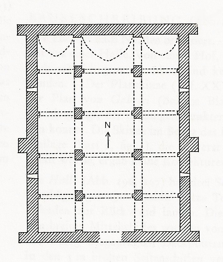 plan drawn by Erdmann |
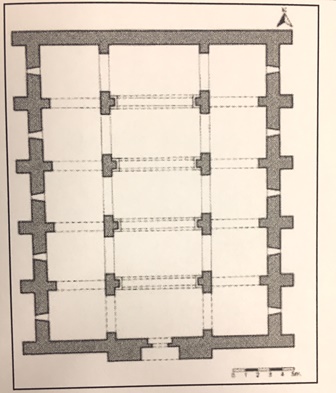 plan drawn by Gündoğdu |
 |
DISTRICT
60 TOKAT
LOCATION
40.0629578, 36.4856262
The Çiftlik Çamlibel Han is located on the
Sivas-Tokat Road, 28km southeast of Tokat and 35 km north of Yildizeli. This road follows the same route as
the former caravan route. Other nearby hans are the Tahtoba Han (in runs) and
the Yildiz Han, now lost.
Çamlibel has always been an important transition point in Anatolia since the Seljuk era, as it is located on the well-traveled Samsun-Baghdad trade route, as well as serving as a link on the Amasya-Turhal-Zile-Kirşehir route. The town was much more important in the Ottoman era, at the time of Tokat's commercial importance in the 16th and 17th centuries, but its activity has considerable diminished since then. Remaining from the Seljuk era are this han and the nearby mosque, both now in ruins.
The Samsun-Sivas road reached the Pazar Hatun Han. From there, a branch road led into Tokat, and another branch road south passed through rugged terrain, curving over mountains before reaching the Ibibse, Tahtoba and Çiftlik-Camlibel Hans. After the Çiftlik-Camlibel Han, it led to the Yeni Han in Yildizeli, which is an Ilhanid period building. The road connected with a flat and straight road coming from Tokat after the Yeni Han. From here, it arrived at Sivas by crossing over the Yildizeli and Kesik Bridges.
NAMES
As the han is located right out of the village of Çamlibel, it also called the Çiftlik-Çamlibel Han. However, the origin of this name is unknown.
It is also known as the Yildiz Han (by Halil Erden) or the Temene Han (by Riefstahl).
DATE
1238-46
REIGN OF
Giyaseddin Keyhüsrev II
PATRON
The inscription, which would have identified the han, has been lost, and, as
such, it is not possible to determine the identity of the patron or the building
date. However, there is a common view that most of the hans in the Tokat area
were built by Mahperi Hunat Hatun between 1238-46.
BUILDING TYPE
Covered section with an open courtyard (COC)
Covered
section is smaller than the courtyard
Covered section with 3 naves (a middle nave and 2 lateral aisles) perpendicular
to the rear wall
5 lines of support cross-vaults parallel to the rear wall
DESCRIPTION
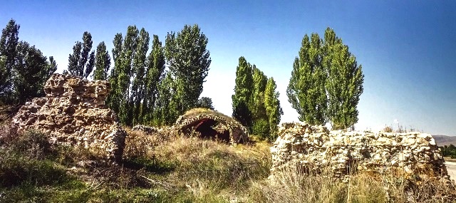
The Çiftlik Çamlibel Han is
oriented north-south and its entrance faces the south towards Yildizeli. This han shares the same
plan as the nearby Tahtoba Han, as both have a covered section for lodging and
shelter and an open courtyard with service facilities. The courtyard section no
longer exists.
Covered section:
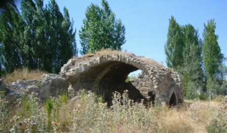
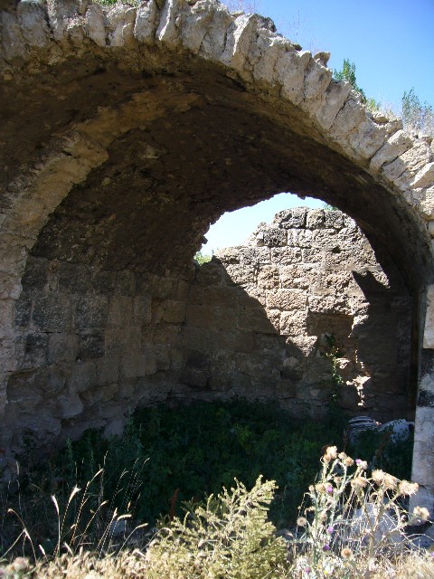
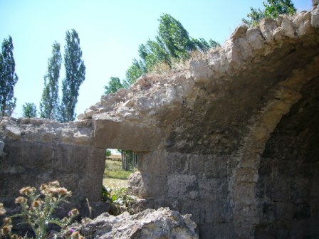
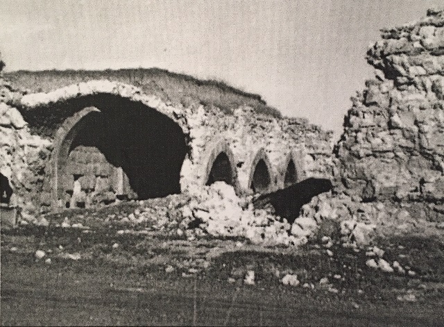
The covered section comprises three naves separated by two support walls, each placed on four square piers linked by pointed arches. The naves are covered with pointed vaults in the north-south direction. The central nave is higher and wider than the lateral ones. The naves are also connected with horizontal support lines running in the east-west direction. Recent excavations have revealed traces of a raised loading platform located in the central nave.
The interior of the covered section was lit by square windows positioned in the east and west walls in the middle of the second and fourth cross-vaults.
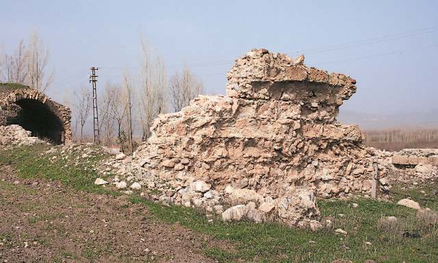
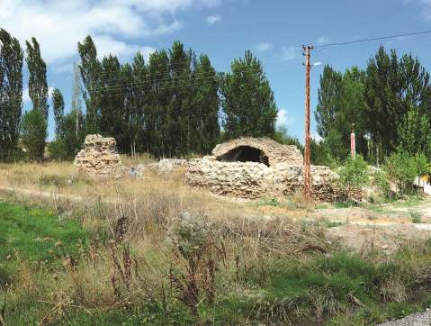
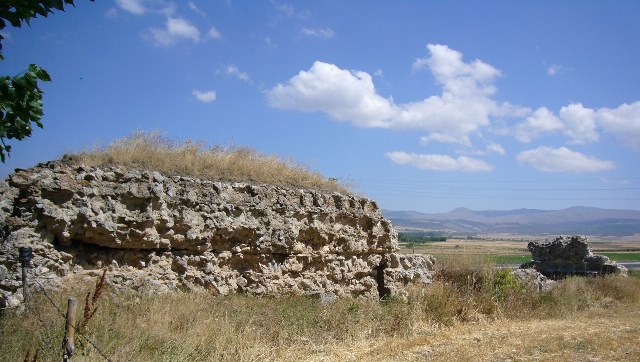
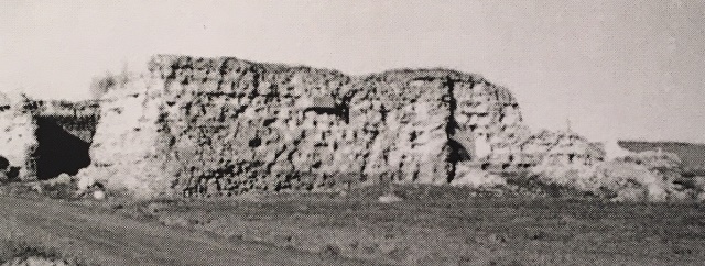
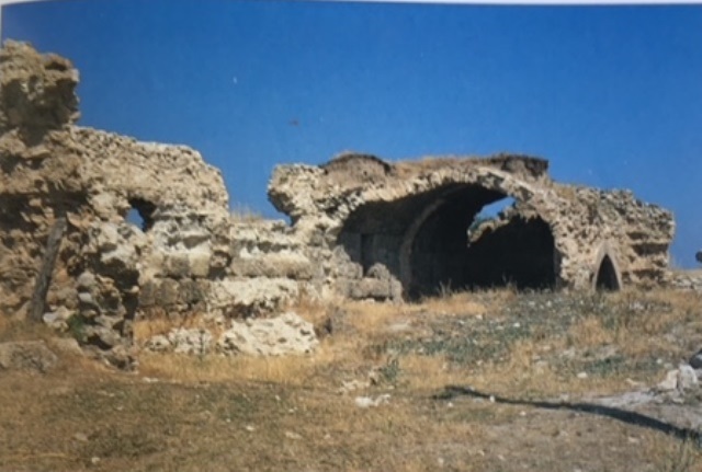
The crown door no longer exists. As can be determined from old photographs, it was on the southern wall and opened directly into the central nave. Traces in front of the covered section show that the han offered service facilities, as can be seen in the photograph taken by Gabriel in 1934. A section of the northern wall, a section of the north-west nave, and a part of the southern wall which would have held the crown door are still standing. The rest of the han has completely collapsed. The north-west wall and the nave are in sound condition and provide information concerning the covering and the plan of the structure.
EXTERIOR
Square support towers existed in the corners and in the middle of the east and west walls.
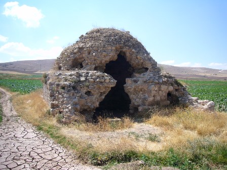
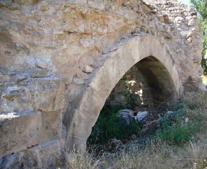
No mosque was found in the han, but a local mosque is located 7 km from the han. This mosque is called the Düdü Mosque. It has a square plan and is believed to have been built at the same time as the han. This han resembles the many small neighborhood mosques built in Konya in the 13th century. The mihrab, still visible in old archival photographs, has now crumbled. The mosque probably served the many travelers along the road, as well as the local villagers.
DECORATION
There is no trace of decoration. Erdmann noted the mason marks on the cut stones of the structure and classified them by typology. However, the majority of the stones with these marks have been lost.
DIMENSIONS
The total area is 630 m2 (19 x 27m)
STATE OF CONSERVATION, CURRENT USE
A section of the northern wall, a section of the north nave, and a
part of the southern wall which would have held the crown door, are still
standing. The rest of the han has completely collapsed and is in ruins.
The han appeared to be in solid condition in photographs taken in 1926. Over the years, the stones of the walls have been appropriated for other constructions, and, as a result, the condition of the han quickly deteriorated.
After your visit, don't miss the opportunity to sample the delicious Tokat specialty, çökelikli pide, at the Çamlibel Pide Salonu across from the han: it's the best in the region according to the locals.
BIBLIOGRAPHIC REFERENCES
Atak, Erkan. “Tokat Çamlibel’deki Türk Dönemi Yapilari.” Akademik Sosyal Araştirmalar Dergisi 54, October 2017, pp. 233-259.
Bilici, Z. Kenan. Anadolu Selçuklu Çaği Mirası. Mimarı = Heritage of Anatolian Seljuk Era. Architecture. 3 vols. Ankara: Türkiye Cumhuriyeti Cumhurbaşkanlığı: Selçuklu Belediyesi, 2016, vol. 3, p. 400.
Childs, W. J. Across Asia Minor on Foot. Edinburgh: Blackwood, 1917, p. 129.
Eravşar, Osman. Yollarin Taniklari (Witnesses of the Way), 2017, pp. 127-130.
Erdmann, Kurt. Das Anatolische Karavansaray des 13. Jahrhunderts, 1961, pp. 156-58, no. 44.
Gabriel, A. Monuments turcs d'Anatolie, I, II. 1931, 1934, p. 112, fig. 72; p. 6 image 3.
Görür, Muhammet. “Anadolu Selçuklu Dönemi Kervansaraylari Kataloğu.” Acun, H. Anadolu Selçuklu Dönemi Kervansaraylari. Ankara: Kültür ve Turizm Bakanliği, 2007, p. 489.
Karpuz, H. & Kuş, A. & Dıvarcı, I. & Şimşek, F. Anadolu Selçuklu Eserleri, 2008, v. 2, p. 423.
Özergin, M. Kemal. "Anadolu'da Selcuklu Kervansaraylari", Tarih Dergisi, XV/20, 1965, p. 147, n. 23.
|
|
Eravşar, 2017. p. 127; photo I. Dıvarcı
|
|
Eravşar, 2017. p. 130; photo I. Dıvarcı
|
|
|
ruined mosque near the han
|
|
|
Photo from the archives of the Tokat Vakiflar Genel Mürdürlügü (1926) |
Photo from the archives of the Tokat Vakiflar Genel Mürdürlügü (1926) |
|
|
|
©2001-2026, Katharine Branning; All Rights Reserved.