![]()
The Seljuk Han of Anatolia
DOGALA HAN
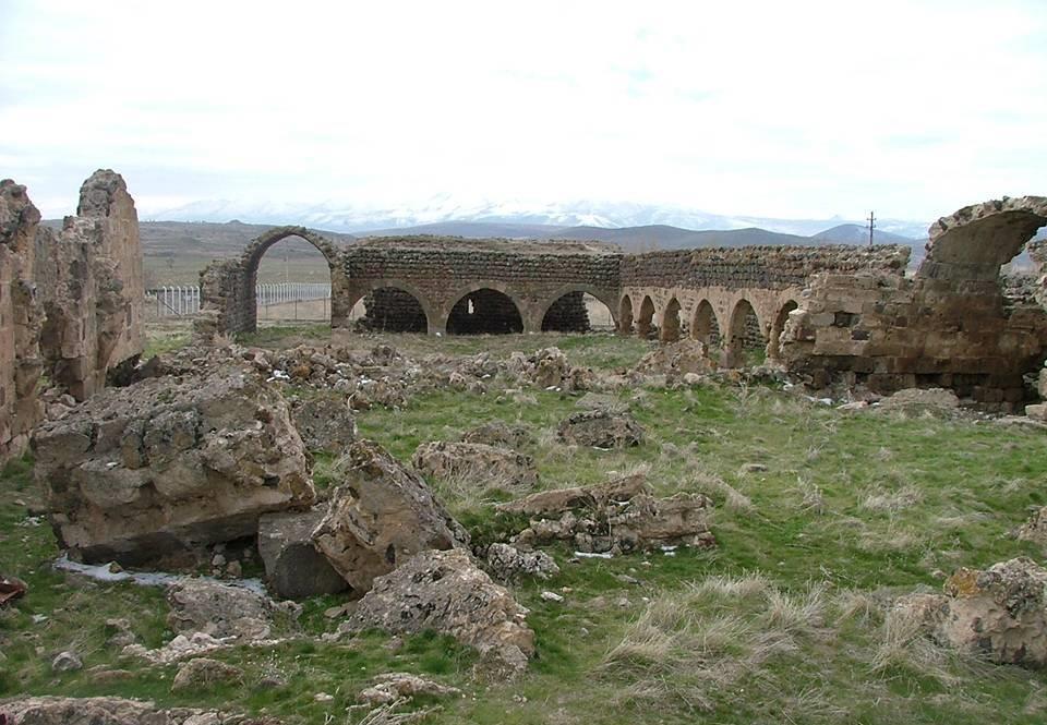
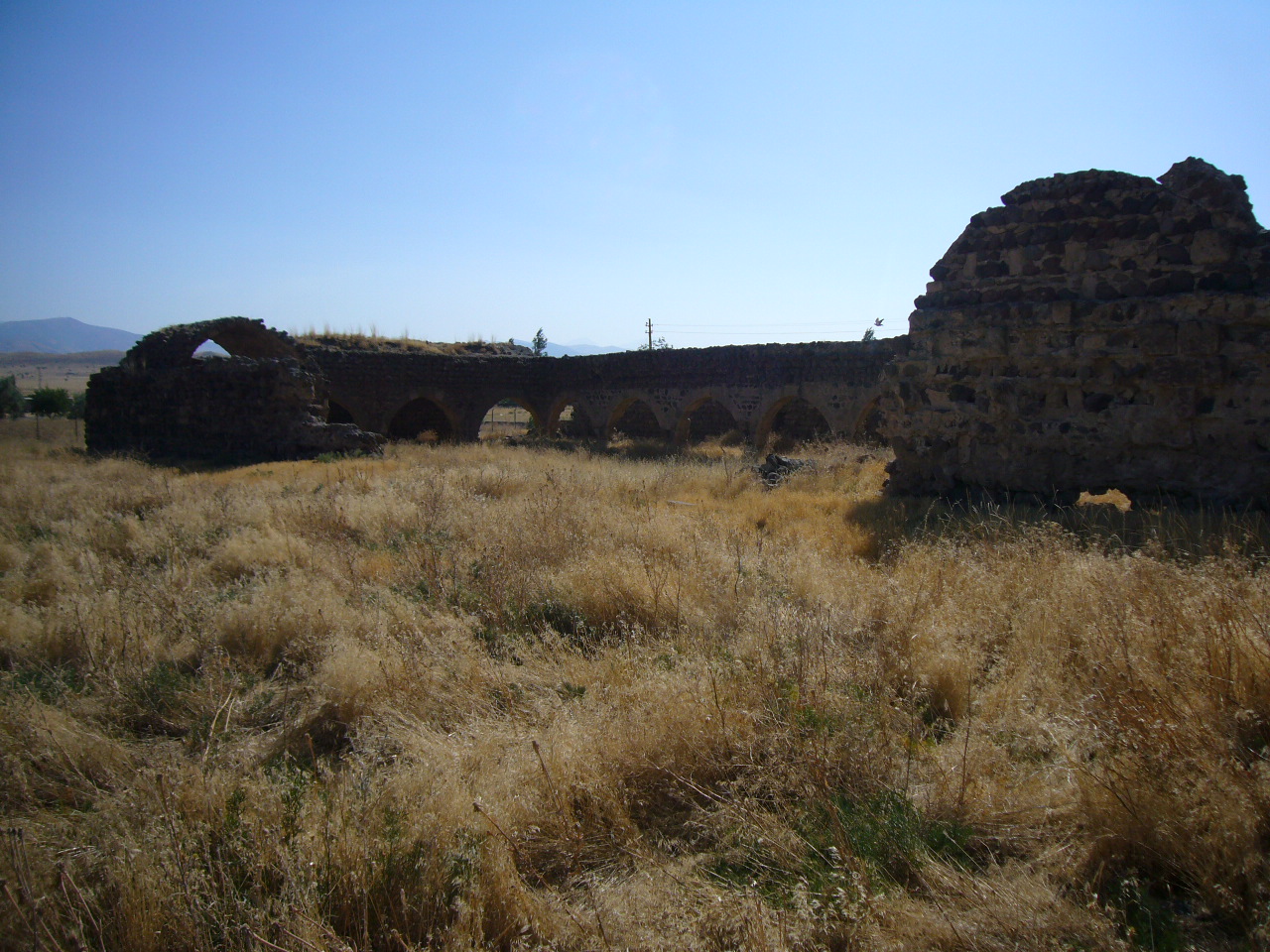
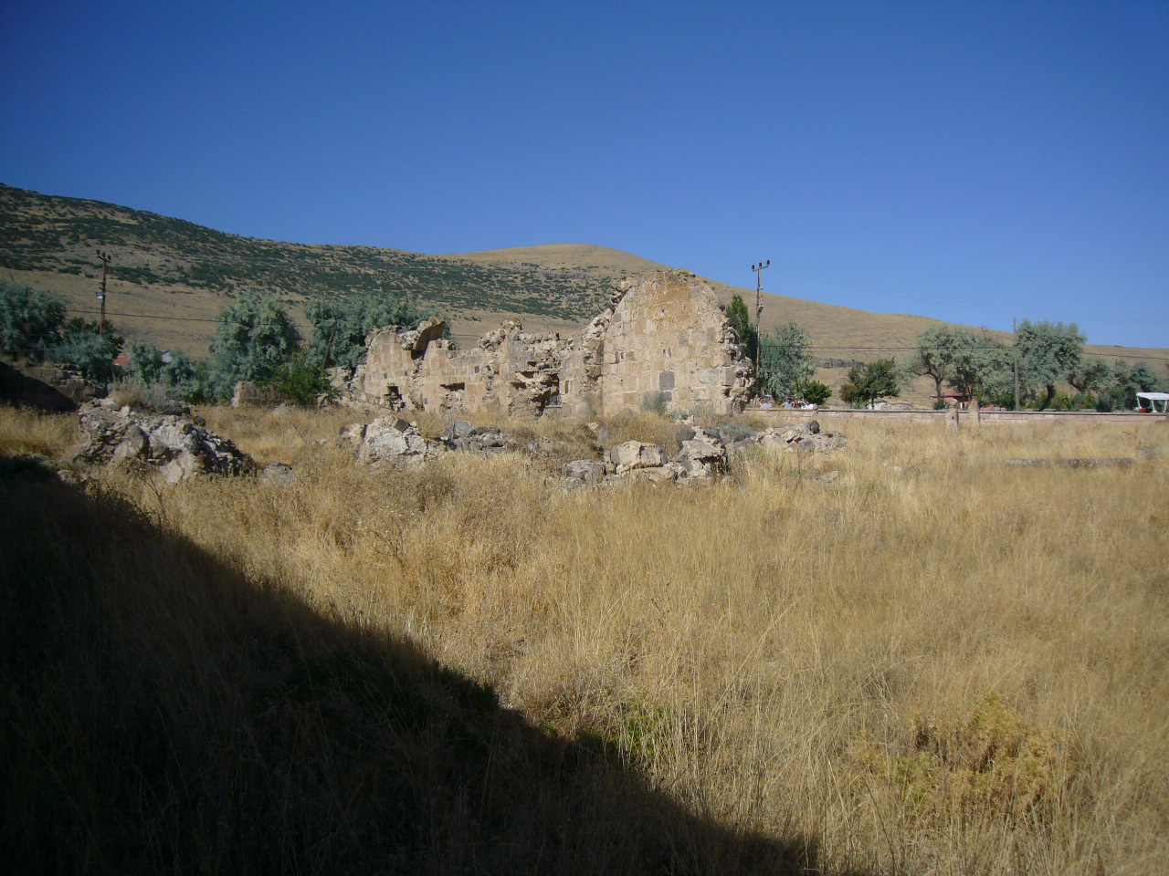
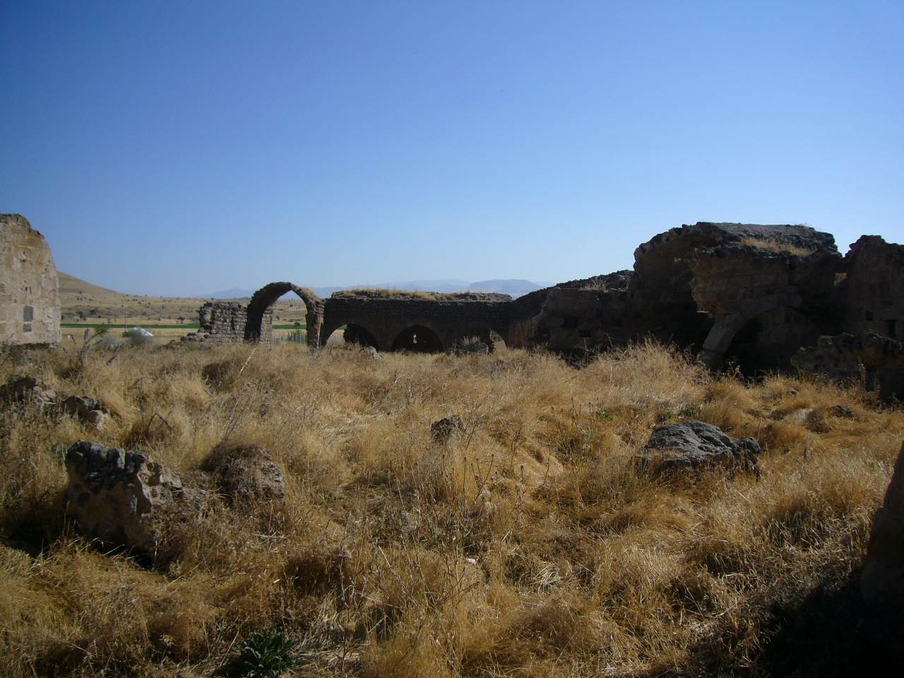
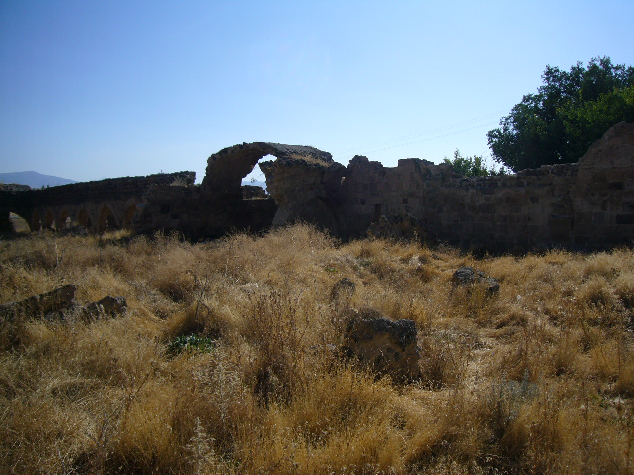
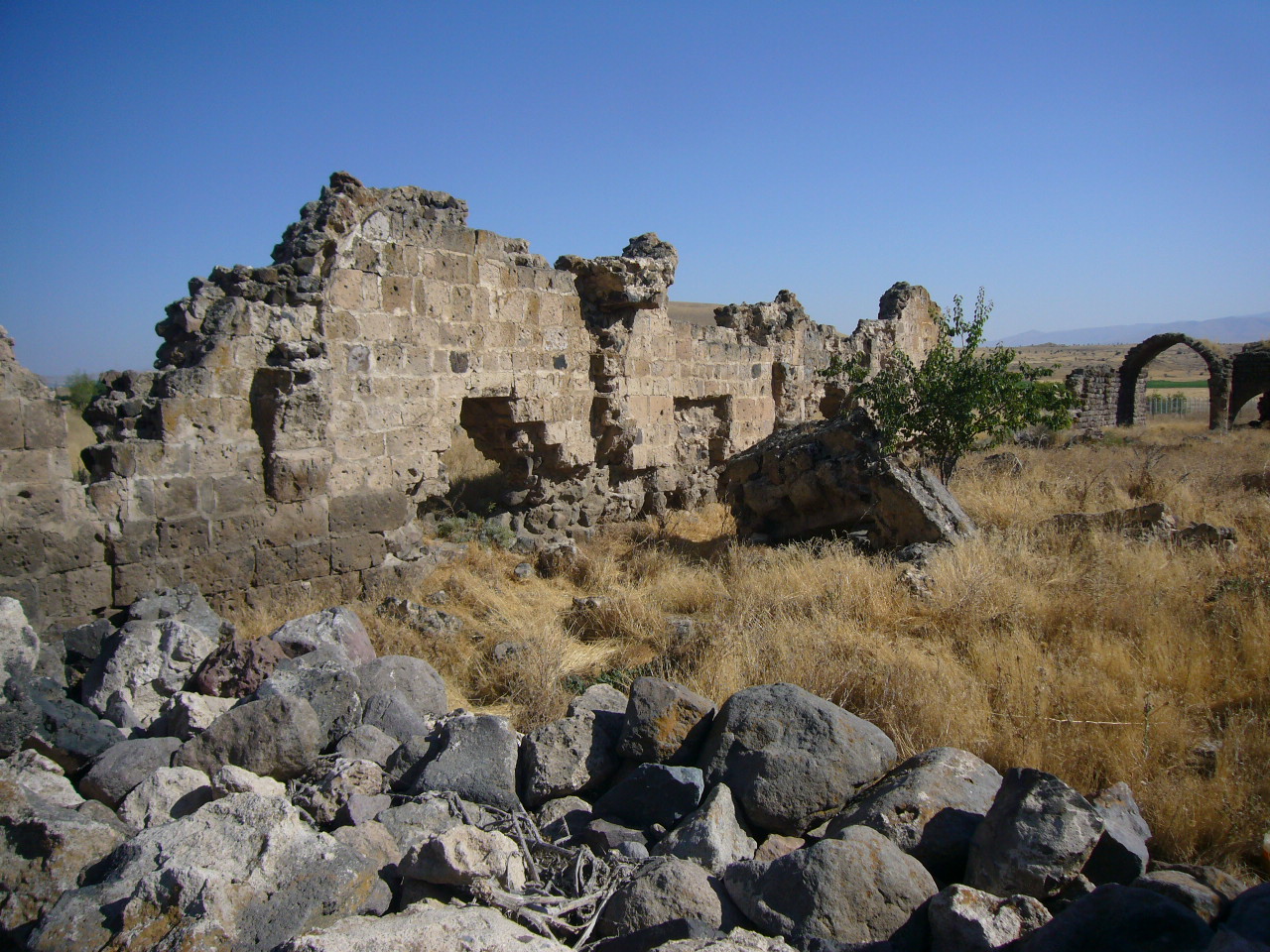
This large han is quite impressive despite its ruined state.
|
|
|
|
|
|
 Karpuz Anadolu Selçuklu Eserleri (2008) v.2, p. 232. |
 Bilici, vol. 3, p. 198 |
|
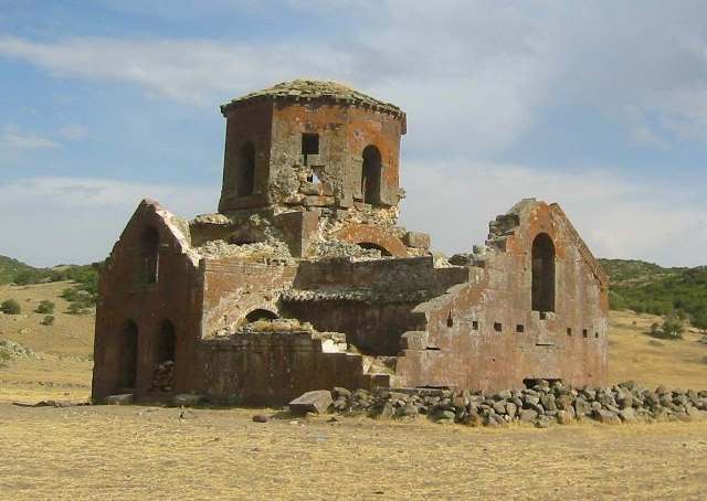 The Byzantine Kizil Kilise ("Red Church) near the han |
DISTRICT
50 NEVŞEHIR
LOCATION
38.431179, 34.597189
The Doğala
Han is located
on the Aksaray-Derinkuyu-Develi road, 10 km from the city center of Derinkuyu
in the village of Doğala (38◦25'52.88◦N
/34B◦35'49.73).
The han was built
on a foothill of Mount Ertaş
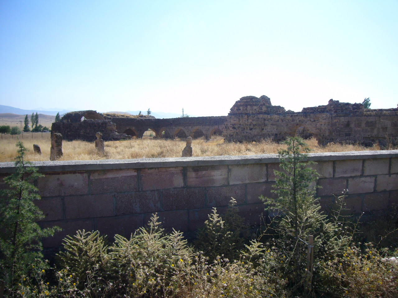
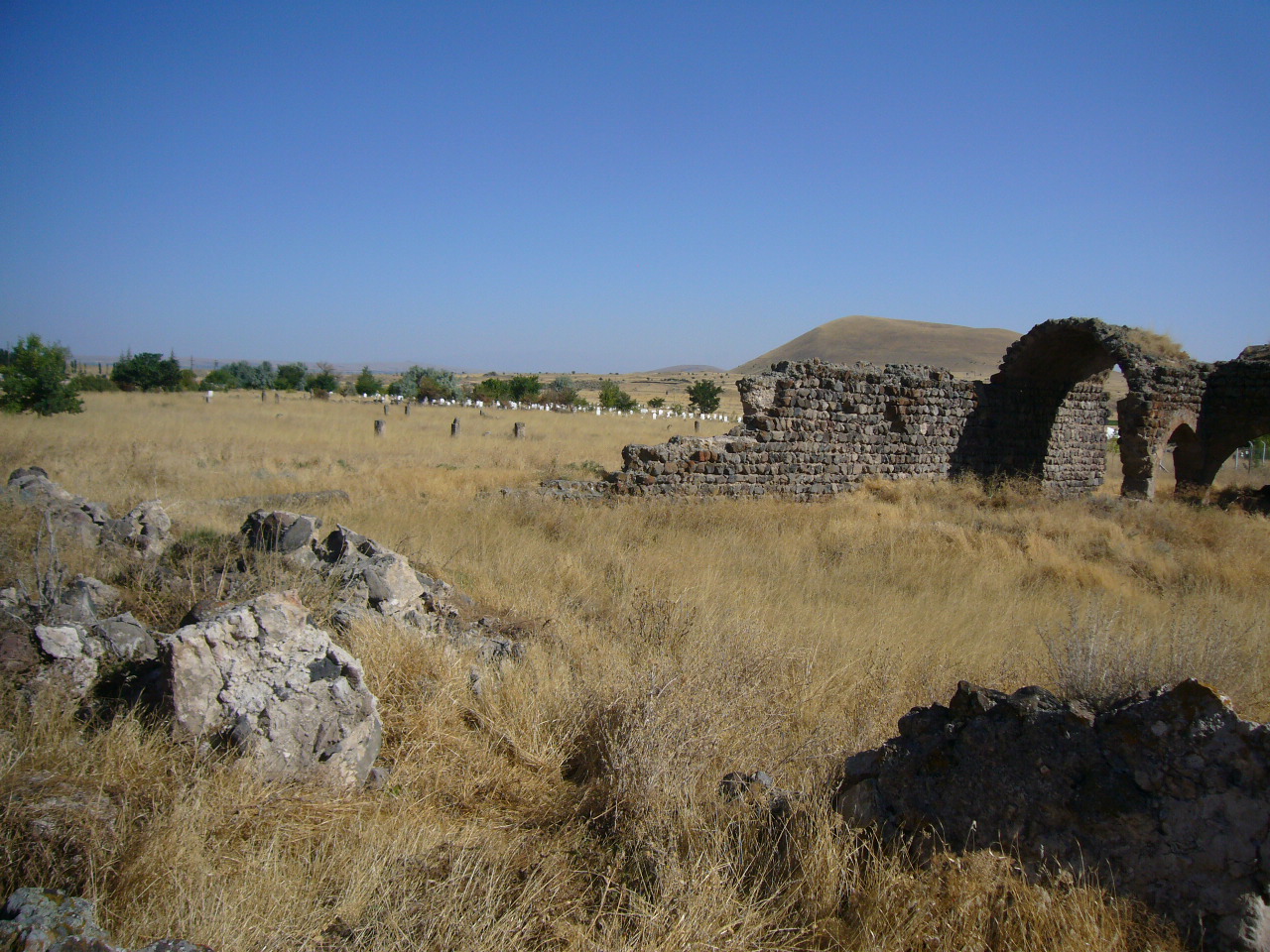
and now lies within the boundaries of the cemetery of the village of Doğala. A
highway passes to the north of the han, and the han is located in the
southeastern edge of the village, in the middle of a cemetery.
The previous han in the direction of Develi is the Dolay Han. The next han in the direction of Aksaray is the Alay Han. There are no traces of the old caravan road which used to pass in front of the han. This road had been in use since the Roman period, going to Kayseri via Nenezi (Bekarlar), Doğala, Yazihöyük, Derinkuyu and Soğanli. Some traces of the road can supposedly be seen around Doğala; however, this road has not been located.
NAMES
It is also known as the Derinkuyu-Doğala Han or the Doğan Han.
The han is not mentioned in Seljuk period historical resources. Although the han is located on an ancient and well-known route, most of the noted voyagers to the region have failed to mention it or any or any other buildings along this road. Rott was the first to mention it, stating that it was an old Byzantine settlement and that the name Doğala was derived from “Doara”, which Rott states was one of the towns of the episcopacy district of Mokissos, which comprised Doara, Nazizanz, Colonia and Parnassos. Hild, in his important work on Byzantine roads in Anatolia, indicates that Tabari and Theopanes relate that in the era of Harun Rashid, Arabs besieged the nearby city of Malakopea, known as Derinkuyu today. Arab geographers also wrote about the region. This region was called Kome in the time of Saint Basil the Great. Kiepert did not mark the han on his maps.
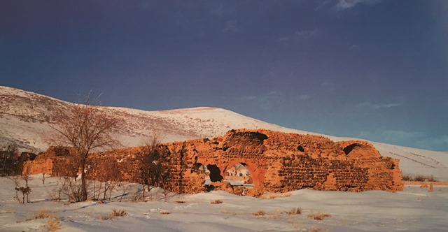
The famous Kızılkilise “Red” Church (the church takes its name from the red stone used to build it) is located on the caravan route near the han. Probably erected in the sixth century during the reign of the Byzantine Emperor Justinian I (r. 527–565), this partially ruined edifice is one of the oldest Christian shrines of the Cappadocia region. Pilgrims traversing Anatolia on the way to Jerusalem along an ancient route could readily reach the church. Gertrude Bell (1868–1926), the British archaeologist and writer, photographed and measured Kizil Kilise in 1907.
DATE
There is no definite information about the patron and building date. Some researchers date the building to the first half of the 13th century, but provide no evidence for this statement. The covered section of the han was probably built in the beginning of the 13th century, or even as late as 1250.
INSCRIPTION
The building has no inscription, so the construction date and patron cannot be determined.
BUILDING TYPE
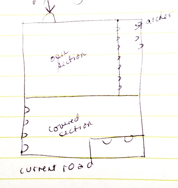
Covered section with an open courtyard (COC)
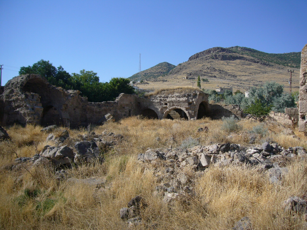
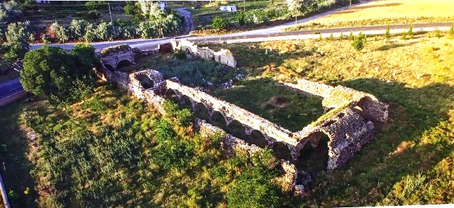
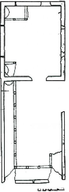
Oriented north to south, the building is composed of service areas around an open courtyard and a covered section. It has a five nave transept plan, with the lateral naves parallel to the central nave, which is the common program in more extensively-developed hans, such as the larger Sultan hans. The plan and decorative features of this han are similar to the Avanos Sari, Ağzikara, Ak, and Susuz Hans.
DESCRIPTION
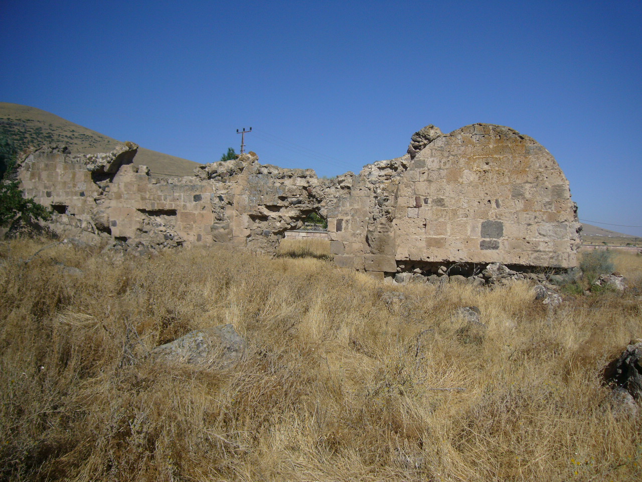
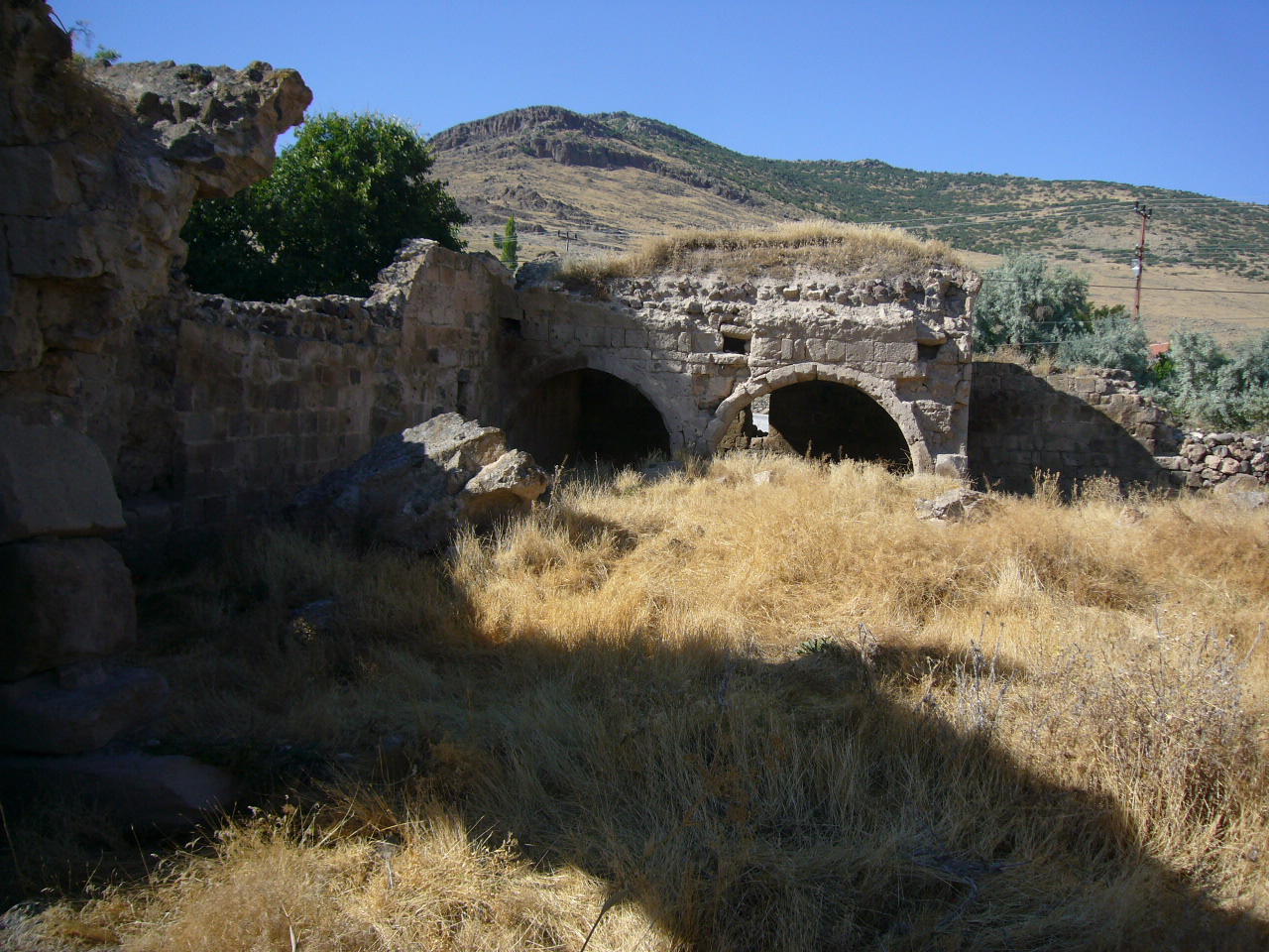
This is a very large han and despite its ruined state, is impressive.
Courtyard:
The courtyard is located to the south of the covered section and is on axis. It is the same width but a bit longer than the covered section. The courtyard is rectangular and is built slightly inclined from north to south. Although the entrance door to the courtyard is completely ruined today, it is possible to determine its location. The entrance was somewhere in the middle of the east side.
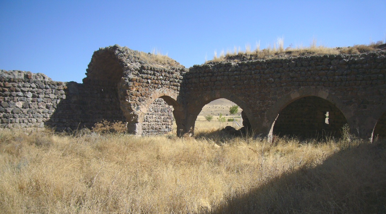
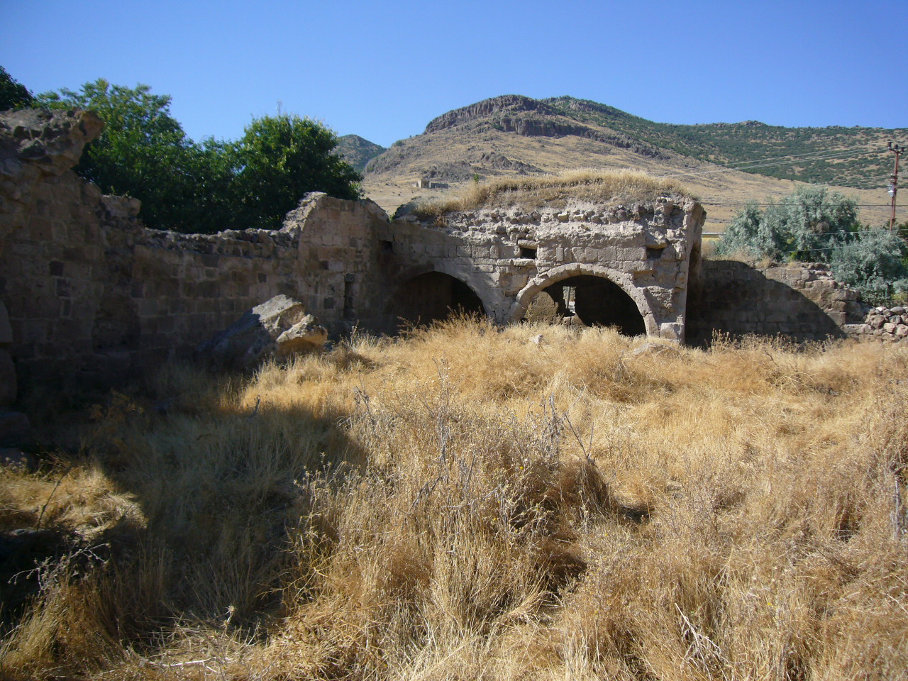
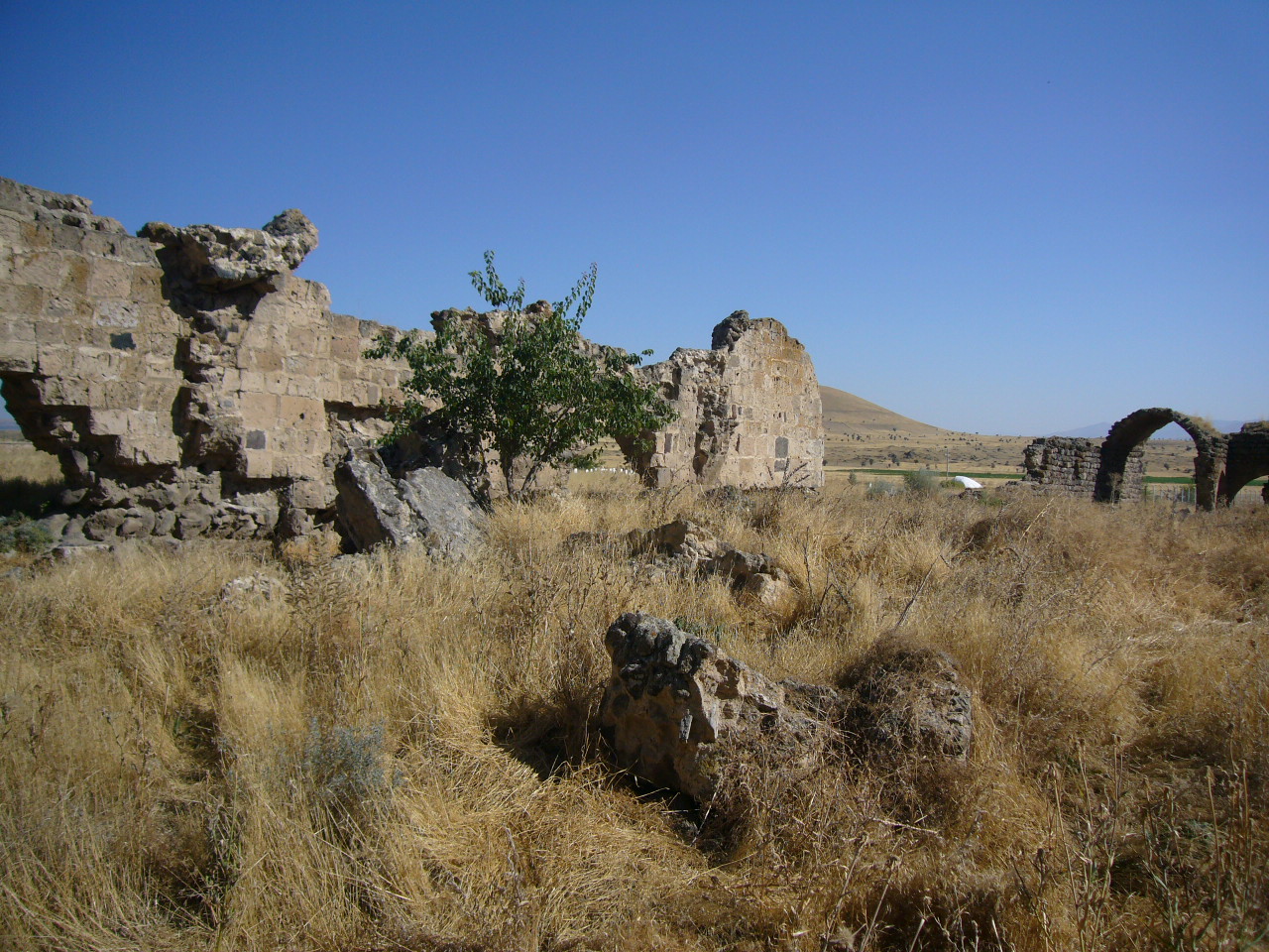
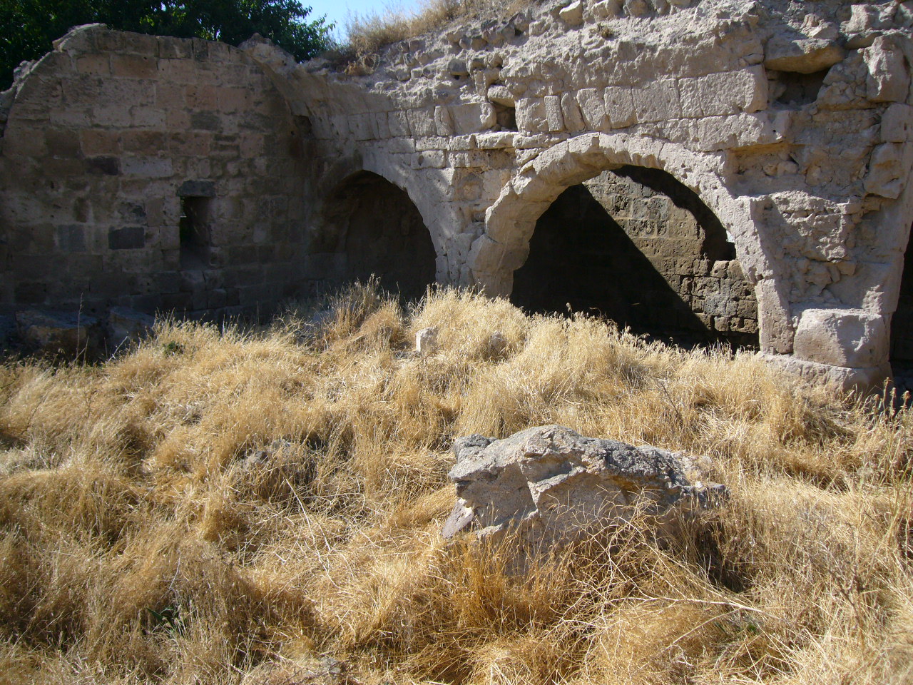
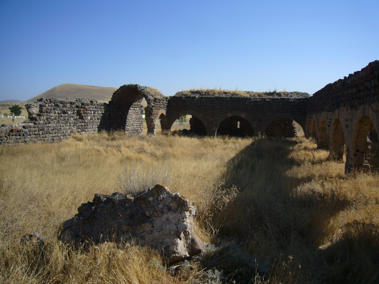
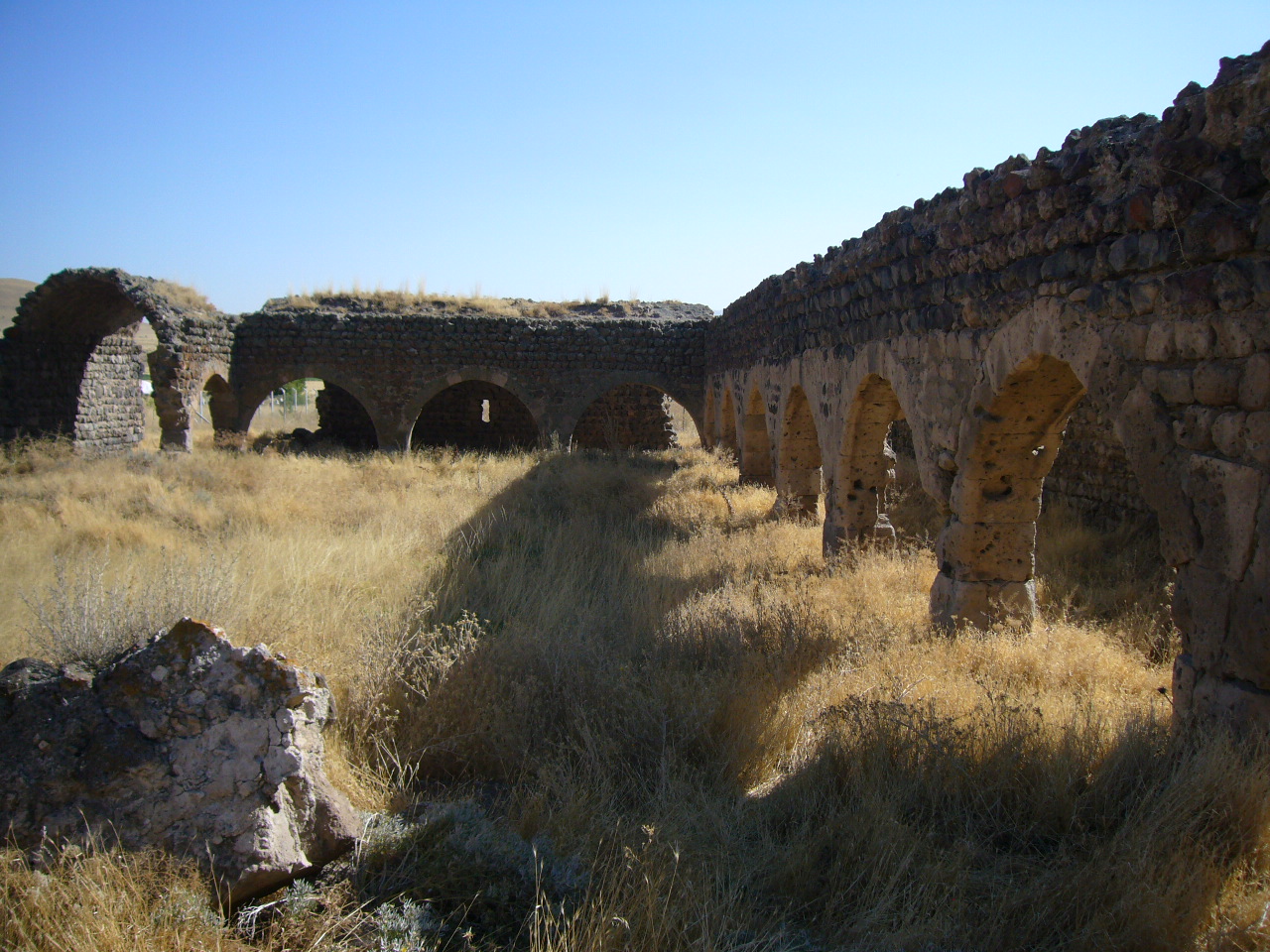
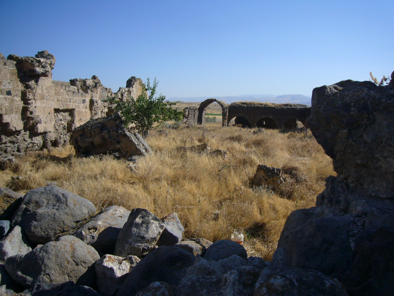
The courtyard is surrounded by arcades on three sides (east, south and west). The piers and vaults of the south and west sections of the arcades are partly solid but the piers on the east side are in ruins. There are traces of the bases of the vaults in the southeast corner. The features of the arcades can be determined by analyzing the arcade still standing on the west side of the courtyard. This arcade, carried by seven square piers, opens onto the court by seven arches covered by pointed barrel vaults in the north-south direction.
The open courtyard was added later to the building after the completion of the covered section. The mismatching of the joints at the meeting points of the walls and the apparent difference between the materials substantiate this claim. The service facilities were built later as complementary units. Smaller pitch-faced basalt stones were used in the walls of the service areas of the courtyard. The piers and arches were made of smooth-faced tufa stones. Some reuse materials can be seen in the walls of this section. The courtyard and the covered section are different from each other as concerns their construction techniques and materials. The covered section of the han is similar to the Avanos Sari, Ağzikara, and Susuz Hans. On the other hand, the han is unique due to its courtyard surrounded by arcades. In this respect, there is no similar building in Anatolia.
Covered section:
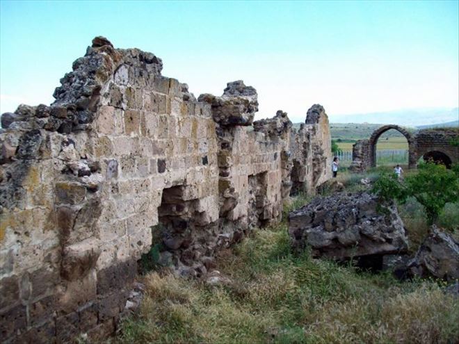
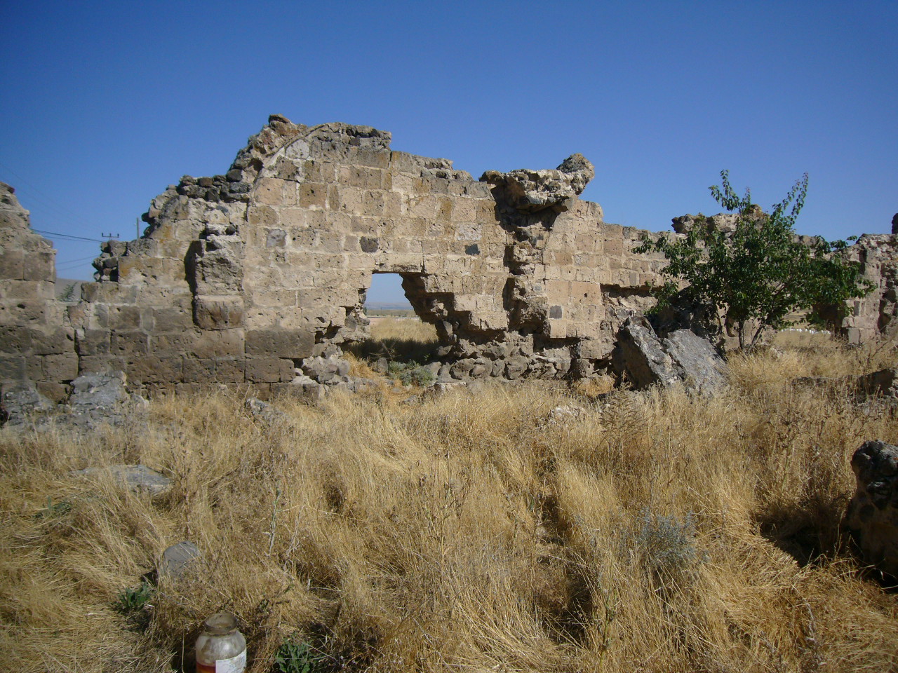
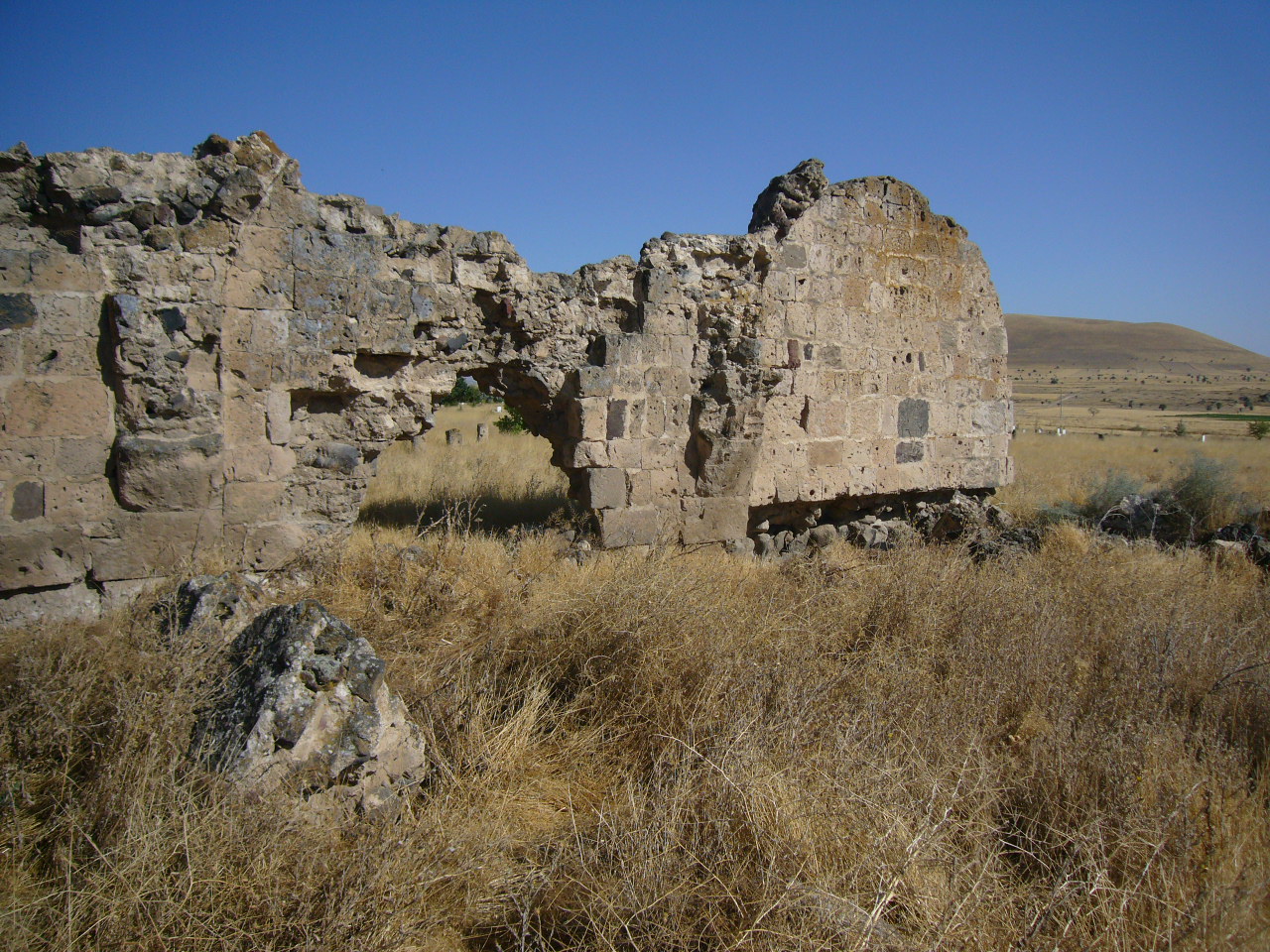
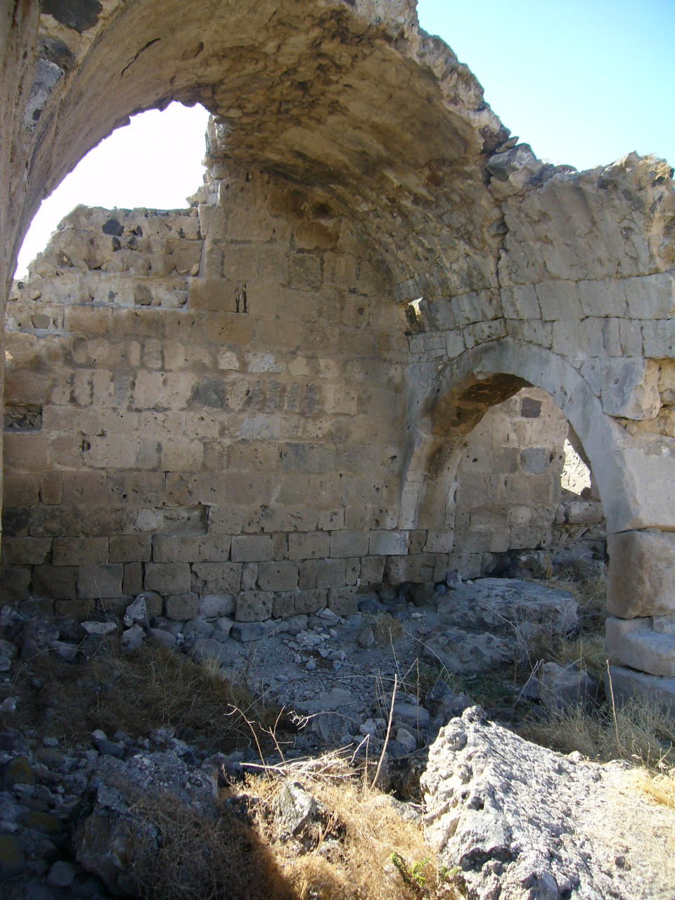
The covered section is smaller than the open courtyard section. There is only one remaining section in each of the side naves, located in the northeast and southwest section of the side naves. These sections are borne by two piers with arches. In addition to these sections, traces of the vault of the central nave can be seen on the north wall.
Despite its ruined state, the support system of the covered section can be read. The naves on each side of the central nave are delineated by two support walls. The covered section is composed of five naves in the north-south direction to the central nave from both sides (east, west), parallel to the rear wall. Each nave is covered by a low, pointed barrel vault. There are four support sections in each of the naves which rest on four square piers. The nave in the center in the north-east direction is covered with a higher vault than the lateral naves. This vault is reinforced with ribbed arches in the east-west direction at the level of the square piers, of which only one remains.
The two-centered pointed arches which carry the central nave in the east-west direction are higher than the arches in the side naves. It is believed that the section of the central nave between the second and third support walls was once covered by a dome; however, no traces of it exist today.
The remains of the ruins inside the northeast corner of the vaulted section reveal that the space between the piers was designed as a loading platform which are 40 cm higher than the ground.
Lighting of the space is by windows opening to the second and fourth naves in the east and west.
EXTERIOR
There are no support towers on the external walls of the han.
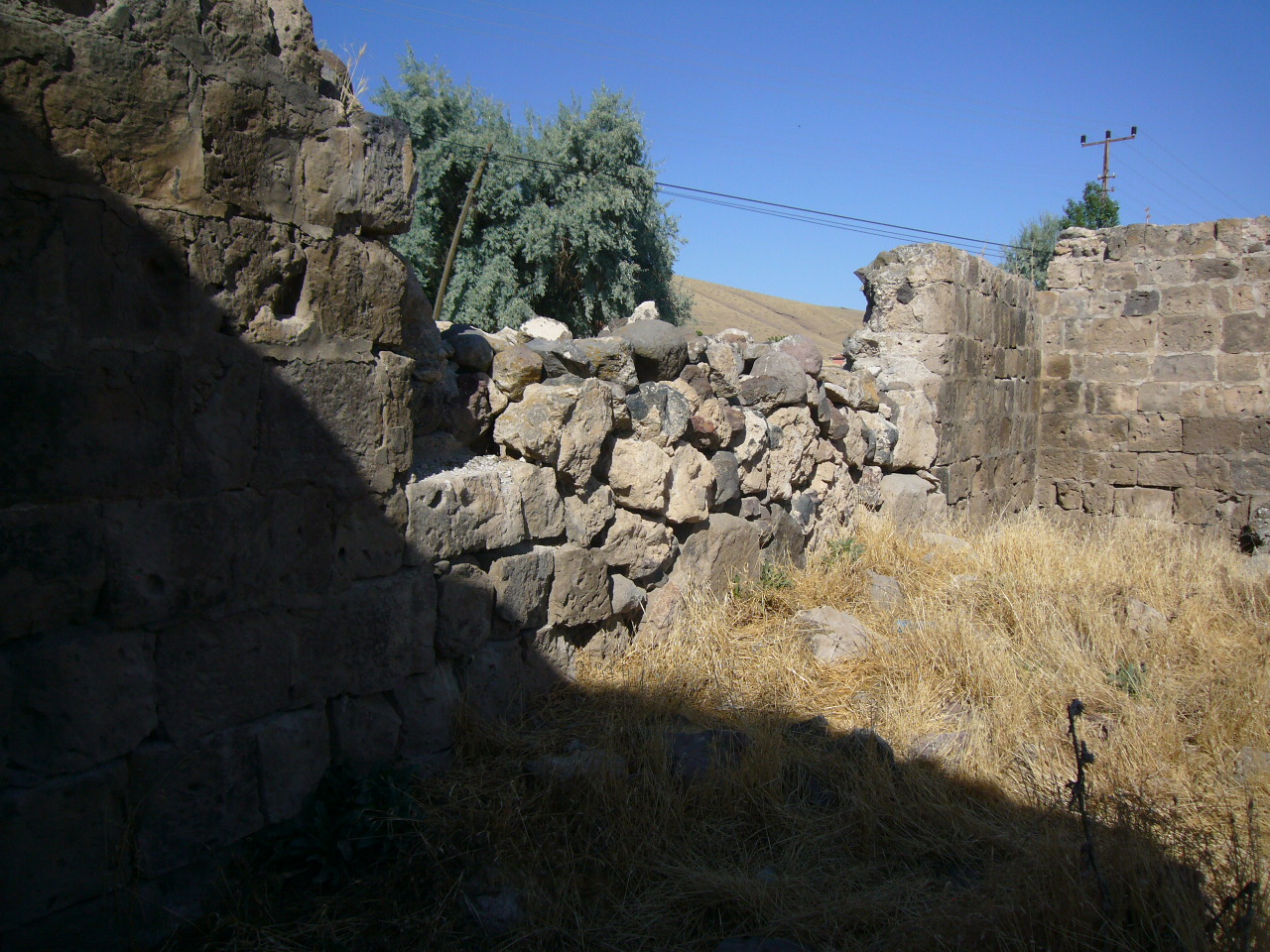
BUILDING MATERIALS
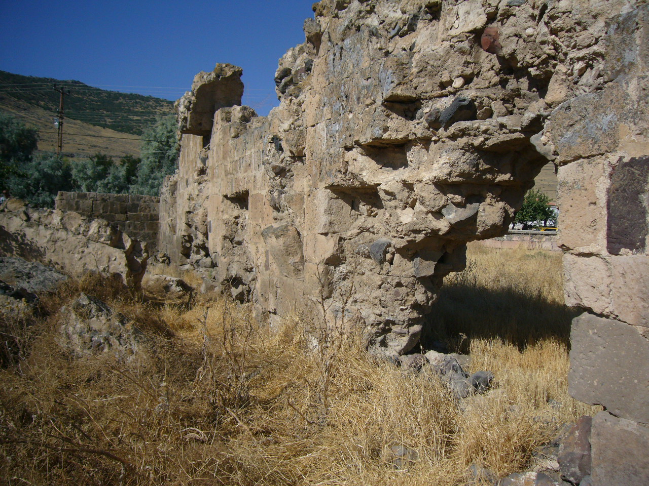
The courtyard and the covered section are different from each other as concerns their construction techniques and materials. The covered section of the han was made of smooth-faced stone. The soft tufa stones brought from nearby quarries are lined with the two-sided wall technique and filled with a mixture of rubble and mortar. The tufa stones, naturally friable, have suffered extensive damage over the years. The walls are built over the main foundation stones at the ground level. There are no mason marks visible on any of the stones of the building.
There are no decorative elements on the building.
STATE OF CONSERVATION, CURRENT USE
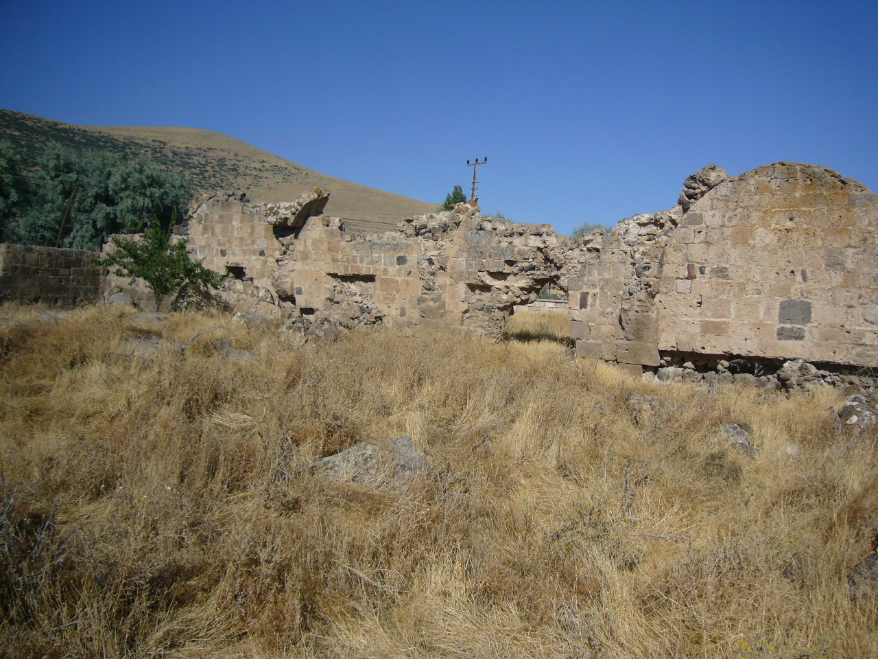
The walls of the covered section are solid, but only the northwest and southwest parts of the vaulted sections of the naves are still standing; the rest having collapsed. The ruins of the crown door of the covered section are still visible. The west and south walls of the courtyard and the arcades here are partly solid. The east wall and its arcade have collapsed. However, this building could be restored to its original plan with proper excavations, and certainly deserves a proper restoration.
BIBLIOGRAPHIC REFERENCES
Bilici, Z. Kenan. Anadolu Selçuklu Çaği Mirası. Mimarı = Heritage of Anatolian Seljuk Era. Architecture. 3 vols. Ankara: Türkiye Cumhuriyeti Cumhurbaşkanlığı: Selçuklu Belediyesi, 2016, vol. 3, p. 198.
Eravşar, Osman. Yollarin Taniklari (Witnesses of the Way), 2017, pp. 189-195.
Hild, F. Das Byzantinische Strassensystem in Kappadokien, 1977, p. 68.
Karpuz, H. & Kuş, A. & Dıvarcı, I. & Şimşek, F. Anadolu Selçuklu Eserleri, vol. 2, 2008, p. 232.
Rott, H. F. Kleinasien Denkmaler aus Psidien, Pamphylien, Kappadokien und Lykien, 1908, p. 284
Yenipinar, Halis. "Kaderine Terkedilmiş Iki Han: Doğala ve Dolay Han." Nevşehir Kültür ve Tarih Araştirmalari, number 6 (November, 2006), pp. 32-36.
The photos below were taken in 2010
|
|
|
|
|
|
|
|
|
|
|
|
|
|
|
|
|
|
|
|
|
|
|
|
©2001-2020 Katharine Branning; All Rights Reserved. No part of this site may be reproduced in any form without written consent from the author.